The Alaska Marine Highway System (AMHS) is a ferry service that operates along the south-central coast of the state of Alaska, the eastern Aleutian Islands and the Inside Passage. As an Environmental Specialist for AMHS, Christy Harrington manages the company’s whale avoidance operating and reporting procedures. Christy has also worked on the gray whale monitoring program in the Okhotsk Sea off the coast of Sakhalin Island, Russia.

The crew of the AMHS vessels serving the coastal waters of Alaska are a valuable monitoring tool in a rich and remote marine environment. Have you noticed any trends in the number or nature of marine mammal incidents (such as strandings, vessel strikes, entanglements and injured animals) that have been reported over the years?
With the increase in cargo shipping, cruise ships and boat traffic in general, vessel strikes are a predominate cause in marine mammal incidents. For Alaska in 2019, only 4 stranding had been reported to the National Marine Fishery Service (NMFS) Mammal Stranding Network. This was significantly lower than reports from 2018 with 16 reported strandings and 2017 with 7 reported strandings. Further investigations were undertaken with necropsy which help to determine the cause of death.
I was able to attend a necropsy of a subadult male humpback in August 2017 which was found on the bulbous bow of the Grand Princess cruise ship. The cause of death from the necropsy was determined to be consistent with a vessel strike. Another interesting necropsy was performed on sperm whale in March 2019. Less than 3 sperm whales are typically reported stranded each year in Alaska and only two necropsy have ever been performed on sperm whales since 1980. The cause of death was consistent with propeller/vessel strike.
One way mariners are preventing whale strikes is by utilizing NOAA Whale Alert Alaska. This is an online application in which mariners can share real-time whale sightings including reporting distressed or dead marine mammals.
Derelict fishing gear i.e. ghost fishing is a leading cause to trapping and entangling not only marine mammals but also fish, sea turtles and sea birds. It restricts their natural movement and leads to starvation and suffocation. It is reported that ghost fishing kills up to ~650,000 marine mammals each year however by spreading awareness, non-governmental organization trying to prevent, detect and collect ghost nets and companies developing biodegradable fishing nets there is hope that the number of marine mammal deaths will decline.
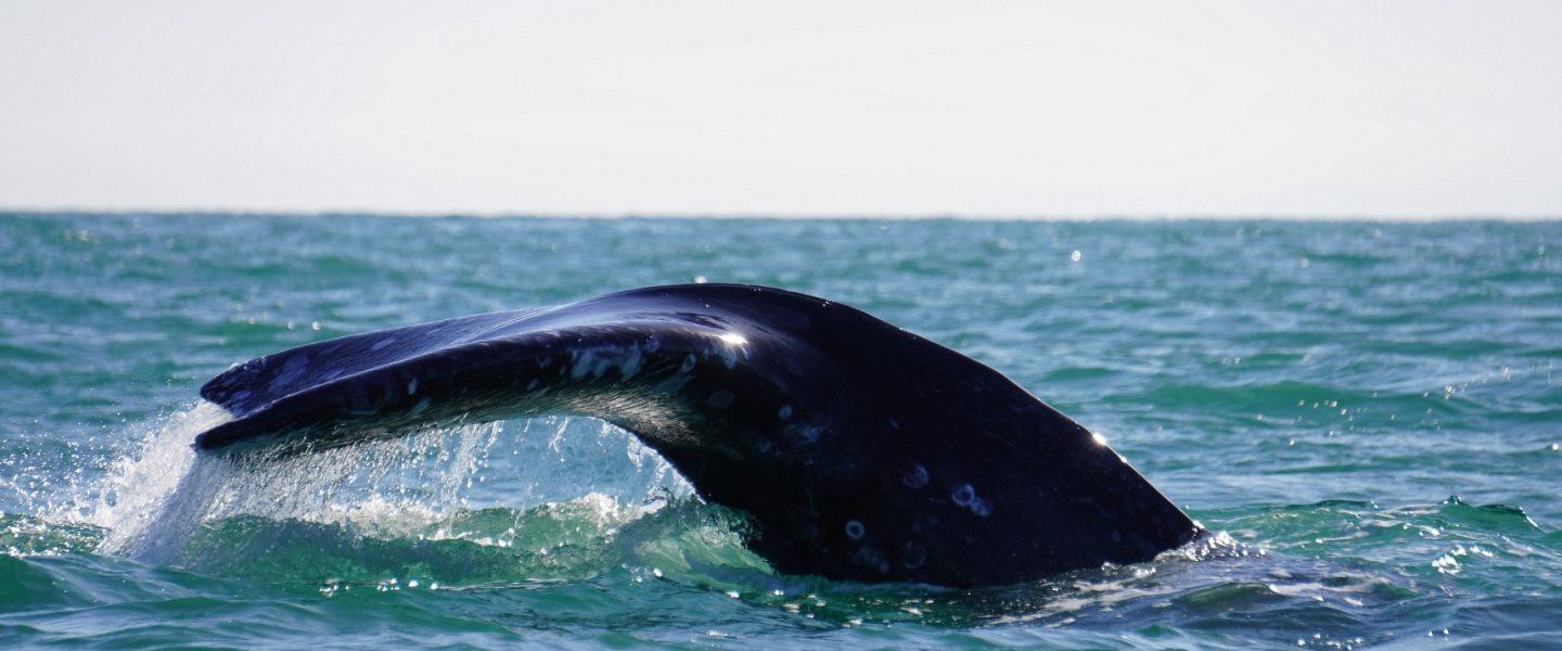
In 2019, elevated gray whale strandings occurred along the west coast and was declared as an Unusual Mortality Event. In Alaska, there were 47 gray whale strandings. In the U.S in total, there were 121 gray whale stranded since September. From the preliminary necropsy, several of the whales showed evidence of emaciation. However, this was not consistent with all of the whales thus NOAA set up a special team of scientist to do a more thorough investigation.
Earlier this year, AMHS started a pilot project on one of their vessels that uses apps (Whale Alert Alaska and Whale Report Alert System) to send and receive real-time information on whale sightings in order to reduce the likelihood of colliding with them. Have you got a feel for how well the pilot project has gone?
The MV Columbia was AMHS first vessel to have a individually designed Apple IPad to be utilized by the crew members to report and view cetacean sightings on a regular basis. The MV Columbia transients from Bellingham, WA to Skagway, AK on a regular revenue schedule. As the State of Washington, Vancouver, B.C and Alaska have sensitive population levels of cetaceans, dolphins and pinnipeds, the pilot project was created to help collect cetacean sighting data and reduce the likelihood of future vessel collisions.
The IPad is equipped with numerous whale reporting apps including: NOAA Whale Alert Alaska to help identify seasonal movements and high density areas to reduce the risk of a whale strike. British Columbia Whale Report Alert System (WRAS) which includes a special app only for pilots and captains which send a text message alert when the vessel is within 10 nm of a reported whale location. It allows the vessel to open a map revealing both the location of the vessel and the whale sighting. And NOAA Whale and Dolphin 911 which allows immediate report of live or dead stranded marine mammals and injured or entangled marine mammals.
It has been a very successful pilot project in which I hope next spring we will expand to our other mainliners. The crew was very involved with the reporting procedure. They always mentioned the different sightings they encountered each time I boarded the vessel. Bringing the technology aboard the vessel allowed the crew to utilize their daily mariner observations in conjunction with the apps to help collect cetacean sightings.
Lastly, how was your time studying the gray whales in the Sea of Okhotsk?
My travels to Far East Russia on the Sea of Okhotsk was quite exciting. Once we flew into Sakhalin, Russia, we proceeded by train north to a city on the coast, Nogliki. We were then picked up by these huge trucks, wheels 5 ft. high which took us out to our make shift camp. The camps population was compose of mostly Russians, two Canadians and two Americans. The only others Russians in the area were fisherman and some reindeer herders. We had to have a protective electric fence around our camp as there were bears in the area and we all lived in small trailer for 6 weeks.
The purpose of the work was to be the land based marine mammal observation crew. There was also a sea based crew on the seismic vessel who would be surveying 5-8 km offshore. In order to protect the Western North Pacific Stock population that has declined to 100-150 individuals, we were there to observe and protect this particular feeding area from the acoustic noise produced from the seismic vessel. The area is primarily used by the mums and calves for feeding so there was a lot of preparation for this survey. A Canadian team, JASCO Applied Science had set up underwater monitors in order to measure the seismic acoustic footprint as to not to exceed certain levels. There were 2 camps, one north and one south and 4 raised platforms or stations for observations. The platforms were approximately 12 ft. high, built of wood with added plastic around the top in order to protect the observers from the elements – which changed frequently: 29° C with very large bugs to 15° C with hail and rain. We had theodolite for visual tracking of the gray whales, computers for input and a radios for communication back to base camp. We also did photo identification of the gray whale population. This is a way to compare individuals who return each year based on patterns on their backs.
Each morning we would drive between 1.5 hours to our station. We would see all sorts of wildlife along the drive, my favorite was the Stellar sea eagles and foxes. I was lucking enough to be at Station 2 which was adjacent to a bay were we sighted a lot of the gray whales who would feed close to the shoreline. Once or twice at high tide they would swim up the bay and we would get very close views of the individuals. There was one day, we were not observing any grays which was particularly odd. Then we found out why – all of a sudden a pod of killers came along the shore line and we watched them stalk and attack a few of the seals in the area.
The grays are such amazing species and it was a huge treat for me. Primarily because it was my first survey with gray whales and being able to observe them up close was spectacular. Secondly, I am an avid photographer and got wonderful shots over the 6 weeks. I was able to learn a bit of Russian and made some wonderful friends along the way. Peter Van Der Wolf was in charge of the whole operation with Sakhalin Energy. The observation project continues each summer and as technology has advanced, Peter now uses drones to achieve aerial footage of the gray whales. This allows dual photographs of both the left and right side of the gray in order for easier identification. Peter has followed their ~12,400 mile migration to Mexico and works with other photo identification organizations to match individuals and evaluate population levels.
